
Gaggal topographic map
Interactive map
Click on the map to display elevation.
About this map
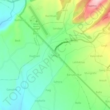
Name: Gaggal topographic map, elevation, terrain.
Location: Gaggal, Kangra, Himachal Pradesh, 176001, India (32.13229 76.25027 32.17229 76.29027)
Average elevation: 755 m
Minimum elevation: 670 m
Maximum elevation: 923 m