
Kurukshetra topographic map
Interactive map
Click on the map to display elevation.
About this map
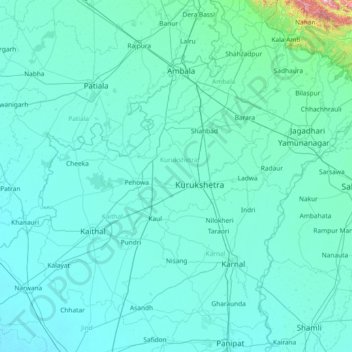
Name: Kurukshetra topographic map, elevation, terrain.
Location: Kurukshetra, Haryana, India (29.36000 76.11000 30.64000 77.39000)
Average elevation: 270 m
Minimum elevation: 221 m
Maximum elevation: 1,680 m
Other topographic maps
Click on a map to view its topography, its elevation and its terrain.