
Perinkottukurushi topographic map
Interactive map
Click on the map to display elevation.
About this map
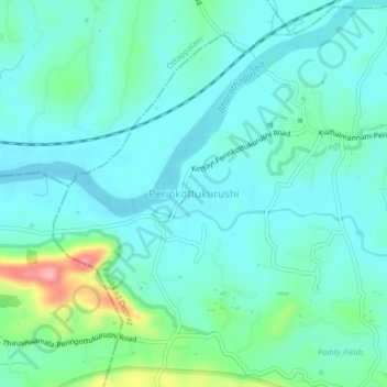
Name: Perinkottukurushi topographic map, elevation, terrain.
Location: Perinkottukurushi, Pālghāt, Palghat, Kerala, India (10.73020 76.46157 10.77020 76.50157)
Average elevation: 61 m
Minimum elevation: 36 m
Maximum elevation: 161 m