
Daang Bakal topographic map
Interactive map
Click on the map to display elevation.
About this map
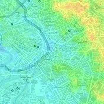
Name: Daang Bakal topographic map, elevation, terrain.
Location: Daang Bakal, Mandaluyong, Metro Manila, Philippines (14.59075 121.02538 14.59596 121.03046)
Average elevation: 13 m
Minimum elevation: 2 m
Maximum elevation: 30 m
Other topographic maps
Click on a map to view its topography, its elevation and its terrain.
New Zañiga
New Zañiga, Mandaluyong, Eastern Manila district, Metro Manila, Philippines
Average elevation: 11 m