
Ward 49 Ghansi Bazar topographic map
Interactive map
Click on the map to display elevation.
About this map
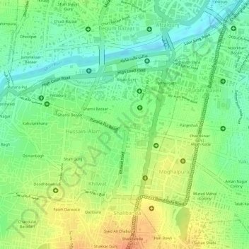
Name: Ward 49 Ghansi Bazar topographic map, elevation, terrain.
Average elevation: 506 m
Minimum elevation: 485 m
Maximum elevation: 527 m
Other topographic maps
Click on a map to view its topography, its elevation and its terrain.
Ward 106 Serilingampally
Ward 106 Serilingampally, Greater Hyderabad Municipal Corporation West Zone, Hyderabad, Serilingampalle mandal, Rangareddy, Telangana, India
Average elevation: 588 m
Ward 104 Kondapur
Ward 104 Kondapur, Greater Hyderabad Municipal Corporation West Zone, Hyderabad, Serilingampalle mandal, Rangareddy, Telangana, India
Average elevation: 582 m
Ward 105 Gachibowli
Ward 105 Gachibowli, Greater Hyderabad Municipal Corporation West Zone, Hyderabad, Serilingampalle mandal, Rangareddy, Telangana, India
Average elevation: 568 m