
Shaki topographic map
Interactive map
Click on the map to display elevation.
About this map
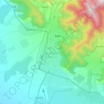
Name: Shaki topographic map, elevation, terrain.
Location: Shaki, Azerbaijan (41.12507 47.13421 41.24397 47.21609)
Average elevation: 639 m
Minimum elevation: 264 m
Maximum elevation: 2,089 m
Other topographic maps
Click on a map to view its topography, its elevation and its terrain.