Geolocate

Snehaetten topographic map

Interactive map

Click on the map to display elevation.

About this map

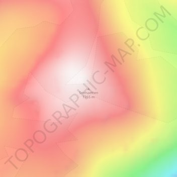
Name: Snehaetten topographic map, elevation, terrain.

Location: Snehaetten, Avannaata, Greenland (71.59704 -53.17524 71.59714 -53.17514)

Average elevation: 1,244 m

Minimum elevation: 360 m

Maximum elevation: 1,699 m

Other topographic maps

Click on a map to view its topography, its elevation and its terrain.

Mestersvig

Greenland

Mestersvig, Greenland

Average elevation: 42 m

Milne Land

Greenland

Milne Land, Sermersooq, Greenland

Average elevation: 39 m

Ilulissat

Greenland > Ilulissat

Ilulissat, Avannaata, 3952, Greenland

Average elevation: 68 m

Helheim Glacier

Greenland

Helheim Glacier, Sermersooq, Greenland

Average elevation: 147 m

Traill-iup Immikkeertivi

Greenland

Traill-iup Immikkeertivi, Sermersooq, Greenland

Average elevation: 0 m

Karale Glacier

Greenland

Karale Glacier, Sermersooq, Greenland

Average elevation: 602 m

Gunnbjørn Fjeld

Greenland

Gunnbjørn Fjeld, Sermersooq, Greenland

Average elevation: 3,251 m

Shannon Island

Greenland

Shannon Island, Sermersooq, Greenland

Average elevation: 18 m

Frederikshaab Glacier

Greenland

Frederikshaab Glacier, Sermersooq, Greenland

Average elevation: 340 m

Nares Land

Greenland

Nares Land, Greenland

Average elevation: 328 m

Geographical Society Island

Greenland

Geographical Society Island, Sermersooq, Greenland

Average elevation: 178 m