
Tahoua topographic map
Interactive map
Click on the map to display elevation.
About this map
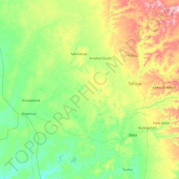
Name: Tahoua topographic map, elevation, terrain.
Location: Tahoua, BP86, Niger (14.47250 4.12047 15.20680 5.66569)
Average elevation: 346 m
Minimum elevation: 252 m
Maximum elevation: 668 m
Other topographic maps
Click on a map to view its topography, its elevation and its terrain.