
Uasin Gishu topographic map
Interactive map
Click on the map to display elevation.
About this map
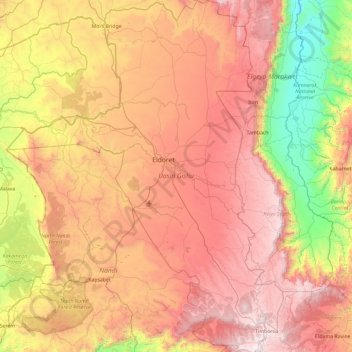
Name: Uasin Gishu topographic map, elevation, terrain.
Location: Uasin Gishu, Kenya (0.00649 34.85349 0.94350 35.59131)
Average elevation: 1,933 m
Minimum elevation: 1,007 m
Maximum elevation: 2,886 m
Other topographic maps
Click on a map to view its topography, its elevation and its terrain.