
Cantón Bagaces topographic map
Interactive map
Click on the map to display elevation.
About this map
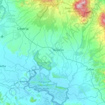
Name: Cantón Bagaces topographic map, elevation, terrain.
Location: Cantón Bagaces, Provincia Guanacaste, Costa Rica (10.24990 -85.43407 10.77751 -85.05828)
Average elevation: 205 m
Minimum elevation: -1 m
Maximum elevation: 1,976 m
Other topographic maps
Click on a map to view its topography, its elevation and its terrain.
Lake Arenal
Costa Rica > Provincia Guanacaste > Tronadora
Lake Arenal, Ruta Nacional 926, Barrio El Zancudero, Tronadora, Cantón Tilarán, Provincia Guanacaste, 50803, Costa Rica
Average elevation: 689 m