
Kicukiro topographic map
Interactive map
Click on the map to display elevation.
About this map
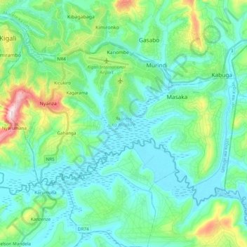
Name: Kicukiro topographic map, elevation, terrain.
Location: Kicukiro, Kigali City, Rwanda (-2.08003 30.04889 -1.95373 30.23934)
Average elevation: 1,428 m
Minimum elevation: 1,332 m
Maximum elevation: 1,809 m
Other topographic maps
Click on a map to view its topography, its elevation and its terrain.
Kigali
Rwanda > Kigali City > Nyarugenge District
Kigali, Nyarugenge District, Kigali City, Rwanda
Average elevation: 1,530 m