
Port-Harcourt topographic map
Interactive map
Click on the map to display elevation.
About this map
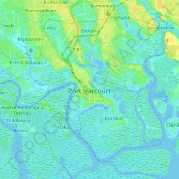
Name: Port-Harcourt topographic map, elevation, terrain.
Location: Port-Harcourt, Rivers State, Nigeria (4.71317 6.94033 4.82407 7.07813)
Average elevation: 5 m
Minimum elevation: -4 m
Maximum elevation: 26 m
Other topographic maps
Click on a map to view its topography, its elevation and its terrain.