
Ajegunle topographic map
Interactive map
Click on the map to display elevation.
About this map
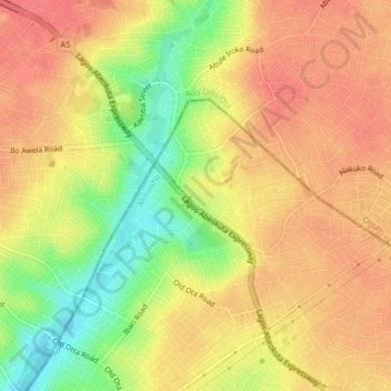
Name: Ajegunle topographic map, elevation, terrain.
Location: Ajegunle, Ifako/Ijaye, Lagos, 2340, Nigeria (6.66694 3.24361 6.70694 3.28361)
Average elevation: 53 m
Minimum elevation: 14 m
Maximum elevation: 75 m