
Pleasant Heights topographic map
Interactive map
Click on the map to display elevation.
About this map
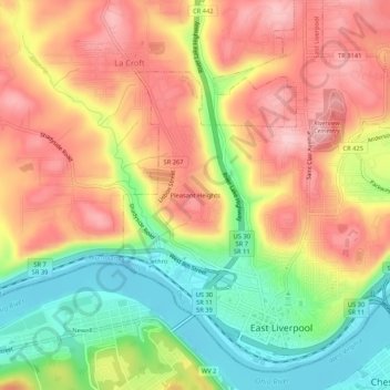
Name: Pleasant Heights topographic map, elevation, terrain.
Location: Pleasant Heights, Columbiana County, Ohio, 26050, USA (40.61229 -80.60896 40.65229 -80.56896)
Average elevation: 300 m
Minimum elevation: 199 m
Maximum elevation: 386 m