
Sukkur topographic map
Interactive map
Click on the map to display elevation.
About this map
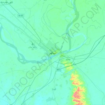
Name: Sukkur topographic map, elevation, terrain.
Location: Sukkur, Shikārpur District, Sindh, Pakistan (27.53619 68.69888 27.85619 69.01888)
Average elevation: 63 m
Minimum elevation: 53 m
Maximum elevation: 138 m
Other topographic maps
Click on a map to view its topography, its elevation and its terrain.
Indus River
Indus River, Lab-e-Mehran Road, Old Sukkur, Sukkur, Shikārpur District, Sindh, Pakistan
Average elevation: 64 m