
NQN topographic map
Interactive map
Click on the map to display elevation.
About this map
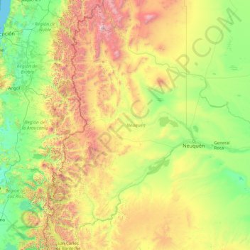
Name: NQN topographic map, elevation, terrain.
Location: NQN, Argentina (-41.10128 -71.96661 -36.05233 -67.99742)
Average elevation: 808 m
Minimum elevation: 0 m
Maximum elevation: 4,668 m
Other topographic maps
Click on a map to view its topography, its elevation and its terrain.