
Elkmont topographic map
Interactive map
Click on the map to display elevation.
About this map
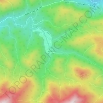
Name: Elkmont topographic map, elevation, terrain.
Location: Elkmont, Sevier County, Tennessee, USA (35.63611 -83.59893 35.67611 -83.55893)
Average elevation: 790 m
Minimum elevation: 524 m
Maximum elevation: 1,085 m
Other topographic maps
Click on a map to view its topography, its elevation and its terrain.
Great Smoky Mountains National Park
Great Smoky Mountains National Park, Little River Trail, Elkmont, Sevier County, Tennessee, USA
Average elevation: 765 m