
Napier topographic map
Interactive map
Click on the map to display elevation.
About this map
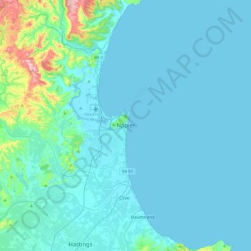
Name: Napier topographic map, elevation, terrain.
Location: Napier, Napier City, Hawke's Bay, 4001, New Zealand (-39.65086 176.75791 -39.33086 177.07791)
Average elevation: 33 m
Minimum elevation: -2 m
Maximum elevation: 369 m
Other topographic maps
Click on a map to view its topography, its elevation and its terrain.
Bluff Hill
Bluff Hill, Napier, Napier City, Hawke's Bay, 4001, New Zealand
Average elevation: 14 m