
Oluyole topographic map
Interactive map
Click on the map to display elevation.
About this map
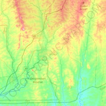
Name: Oluyole topographic map, elevation, terrain.
Location: Oluyole, Oyo, Nigeria (7.08010 3.72477 7.32959 4.01534)
Average elevation: 136 m
Minimum elevation: 57 m
Maximum elevation: 291 m
Other topographic maps
Click on a map to view its topography, its elevation and its terrain.