
Kerling topographic map
Interactive map
Click on the map to display elevation.
About this map
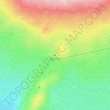
Name: Kerling topographic map, elevation, terrain.
Location: Kerling, Bláskógabyggð, Southern Region, Iceland (64.37287 -20.76352 64.37297 -20.76342)
Average elevation: 560 m
Minimum elevation: 456 m
Maximum elevation: 720 m
Other topographic maps
Click on a map to view its topography, its elevation and its terrain.
Tindfjallajökull
Tindfjallajökull, Hungurfitaskáli, Rangárþing ytra, Southern Region, Iceland
Average elevation: 1,059 m
Þrándarjökull
Þrándarjökull, Djúpavogshreppur, Eastern Region, Iceland
Average elevation: 1,012 m
Kaldaklofsjökull
Kaldaklofsjökull, Laugavegur, Rangárþing ytra, Southern Region, Iceland
Average elevation: 1,035 m