
Olhão topographic map
Interactive map
Click on the map to display elevation.
About this map
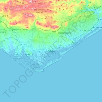
Name: Olhão topographic map, elevation, terrain.
Location: Olhão, Faro, 8700-155, Portugal (36.86704 -8.00113 37.18704 -7.68113)
Average elevation: 56 m
Minimum elevation: -3 m
Maximum elevation: 410 m
Over time the small town of fishermen grew into an economic, social and urban centre, resulting in its elevation in city in 1985. In recent years, it has also developed a growing tourist industry.