
Ikate topographic map
Interactive map
Click on the map to display elevation.
About this map
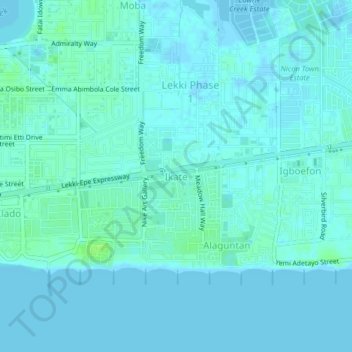
Name: Ikate topographic map, elevation, terrain.
Location: Ikate, Eti Osa, Lagos State, 106104, Nigeria (6.41263 3.46581 6.45263 3.50581)
Average elevation: 3 m
Minimum elevation: -5 m
Maximum elevation: 11 m
Other topographic maps
Click on a map to view its topography, its elevation and its terrain.
Sangotedo
Nigeria > Lagos State > Eti Osa
Sangotedo, Eti Osa, Lagos State, 101245, Nigeria
Average elevation: 5 m
Maiyegun
Nigeria > Lagos State > Eti Osa
Maiyegun, Eti Osa, Lagos State, 105102, Nigeria
Average elevation: 2 m