
Cortelha topographic map
Interactive map
Click on the map to display elevation.
About this map
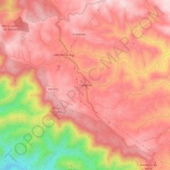
Name: Cortelha topographic map, elevation, terrain.
Location: Cortelha, Salir, Loulé, Faro, 8100-159, Portugal (37.23660 -7.97603 37.27660 -7.93603)
Average elevation: 438 m
Minimum elevation: 199 m
Maximum elevation: 538 m
Other topographic maps
Click on a map to view its topography, its elevation and its terrain.
Barranco do Velho
Barranco do Velho, Salir, Loulé, Faro, 8100-159, Portugal
Average elevation: 426 m