
鸳鸯街道 topographic map
Interactive map
Click on the map to display elevation.
About this map
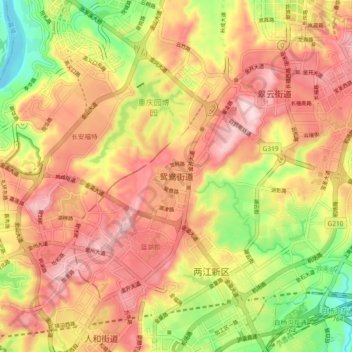
Name: 鸳鸯街道 topographic map, elevation, terrain.
Location: 鸳鸯街道, 渝北区, 重庆市主城都市区, 重庆市, 401122, 中国 (29.62683 106.51331 29.70683 106.59331)
Average elevation: 342 m
Minimum elevation: 160 m
Maximum elevation: 481 m
Other topographic maps
Click on a map to view its topography, its elevation and its terrain.