
Thank you for supporting this site ❤️
Make a donation
Make a donation
Kawit Island topographic map
Click on the map to display elevation.
Thank you for supporting this site ❤️
Make a donation
Make a donation
About this map
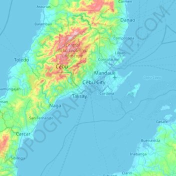
Name: Kawit Island topographic map, elevation, terrain.
Location: Kawit Island, Cebu City, Central Visayas, 6000, Philippines (10.27148 123.87905 10.27158 123.87915)
Average elevation: 1 m
Minimum elevation: -4 m
Maximum elevation: 7 m
Thank you for supporting this site ❤️
Make a donation
Make a donation
Other topographic maps
Click on a map to view its topography, its elevation and its terrain.