
Thank you for supporting this site ❤️
Make a donation
Make a donation
Windsor Forest topographic map
Click on the map to display elevation.
Thank you for supporting this site ❤️
Make a donation
Make a donation
About this map
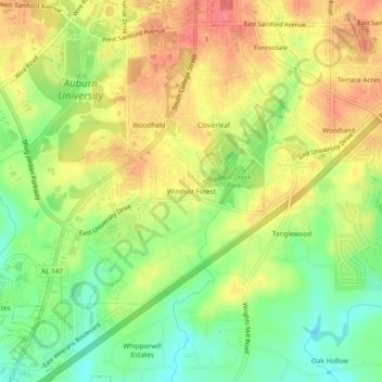
Name: Windsor Forest topographic map, elevation, terrain.
Average elevation: 189 m
Minimum elevation: 155 m
Maximum elevation: 219 m
Thank you for supporting this site ❤️
Make a donation
Make a donation
Other topographic maps
Click on a map to view its topography, its elevation and its terrain.
Louise Kreher Forest Ecology Preserve
United States > Alabama > Lee County > Auburn > Farmville
Average elevation: 204 m