
Thank you for supporting this site ❤️
Make a donation
Make a donation
Strömbo topographic map
Click on the map to display elevation.
Thank you for supporting this site ❤️
Make a donation
Make a donation
About this map
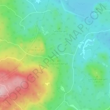
Name: Strömbo topographic map, elevation, terrain.
Location: Strömbo, Falu kommun, Dalarna County, 790 20, Sweden (60.64631 15.41010 60.68631 15.45010)
Average elevation: 209 m
Minimum elevation: 136 m
Maximum elevation: 388 m
Thank you for supporting this site ❤️
Make a donation
Make a donation
Other topographic maps
Click on a map to view its topography, its elevation and its terrain.