
Thank you for supporting this site ❤️
Make a donation
Make a donation
Fort Run topographic map
Click on the map to display elevation.
Thank you for supporting this site ❤️
Make a donation
Make a donation
About this map
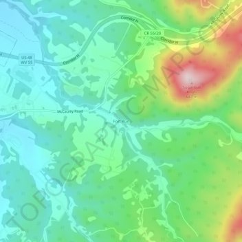
Name: Fort Run topographic map, elevation, terrain.
Location: Fort Run, Hardy County, West Virginia, 26836, United States (39.04677 -78.94253 39.08677 -78.90253)
Average elevation: 357 m
Minimum elevation: 248 m
Maximum elevation: 641 m
Thank you for supporting this site ❤️
Make a donation
Make a donation
Other topographic maps
Click on a map to view its topography, its elevation and its terrain.