
Euharlee topographic map
Click on the map to display elevation.
About this map
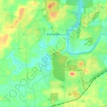
Name: Euharlee topographic map, elevation, terrain.
Location: Euharlee, Bartow County, Georgia, United States (34.10867 -84.96057 34.16179 -84.90136)
Average elevation: 215 m
Minimum elevation: 195 m
Maximum elevation: 248 m
Other topographic maps
Click on a map to view its topography, its elevation and its terrain.