
Thank you for supporting this site ❤️
Make a donation
Make a donation
Fort Branch topographic map
Click on the map to display elevation.
Thank you for supporting this site ❤️
Make a donation
Make a donation
About this map
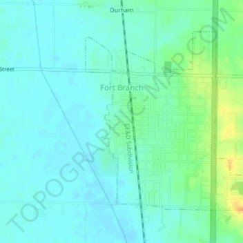
Name: Fort Branch topographic map, elevation, terrain.
Location: Fort Branch, Gibson County, Indiana, 47648, United States (38.23744 -87.58628 38.25736 -87.55921)
Average elevation: 136 m
Minimum elevation: 127 m
Maximum elevation: 160 m
Thank you for supporting this site ❤️
Make a donation
Make a donation
Other topographic maps
Click on a map to view its topography, its elevation and its terrain.