
Thank you for supporting this site ❤️
Make a donation
Make a donation
Rumenes topographic map
Click on the map to display elevation.
Thank you for supporting this site ❤️
Make a donation
Make a donation
About this map
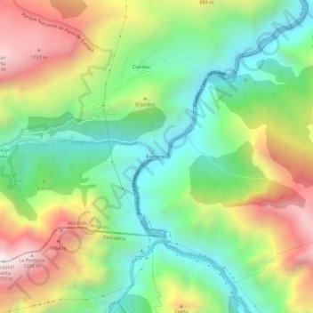
Name: Rumenes topographic map, elevation, terrain.
Location: Rumenes, Peñamellera Baja, Asturias, 39580, España (43.25793 -4.65317 43.29793 -4.61317)
Average elevation: 515 m
Minimum elevation: 37 m
Maximum elevation: 1,258 m
Thank you for supporting this site ❤️
Make a donation
Make a donation