
Avon topographic map
Interactive map
Click on the map to display elevation.
About this map
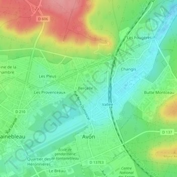
Name: Avon topographic map, elevation, terrain.
Average elevation: 88 m
Minimum elevation: 49 m
Maximum elevation: 154 m
Other topographic maps
Click on a map to view its topography, its elevation and its terrain.
Chessy
Frankreich > Île-de-France > Seine-et-Marne
Chessy, Torcy, Seine-et-Marne, Île-de-France, Metropolitanes Frankreich, 77700, Frankreich
Average elevation: 110 m
La Genevraye
Frankreich > Île-de-France > Seine-et-Marne
La Genevraye, Fontainebleau, Seine-et-Marne, Île-de-France, Metropolitanes Frankreich, 77690, Frankreich
Average elevation: 66 m
Melun
Frankreich > Île-de-France > Seine-et-Marne
Melun, Seine-et-Marne, Île-de-France, Metropolitanes Frankreich, 77000, Frankreich
Average elevation: 66 m