
Thank you for supporting this site ❤️
Make a donation
Make a donation
Matraia topographic map
Click on the map to display elevation.
Thank you for supporting this site ❤️
Make a donation
Make a donation
About this map
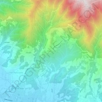
Name: Matraia topographic map, elevation, terrain.
Location: Matraia, Capannori, Lucca, Tuscany, 55014, Italy (43.89262 10.55162 43.93262 10.59162)
Average elevation: 298 m
Minimum elevation: 34 m
Maximum elevation: 957 m
Thank you for supporting this site ❤️
Make a donation
Make a donation