
Thank you for supporting this site ❤️
Make a donation
Make a donation
The Pines topographic map
Click on the map to display elevation.
Thank you for supporting this site ❤️
Make a donation
Make a donation
About this map
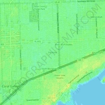
Name: The Pines topographic map, elevation, terrain.
Average elevation: 9 m
Minimum elevation: 0 m
Maximum elevation: 17 m
Thank you for supporting this site ❤️
Make a donation
Make a donation
Other topographic maps
Click on a map to view its topography, its elevation and its terrain.
Alice C Wainwright Park
United States > Florida > Miami-Dade County > Miami > Brickell Hammock
Average elevation: 6 m
Thank you for supporting this site ❤️
Make a donation
Make a donation