
Thank you for supporting this site ❤️
Make a donation
Make a donation
Winterborne Monkton topographic map
Click on the map to display elevation.
Thank you for supporting this site ❤️
Make a donation
Make a donation
About this map
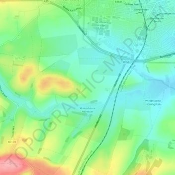
Name: Winterborne Monkton topographic map, elevation, terrain.
Location: Winterborne Monkton, Dorset, England, United Kingdom (50.67602 -2.47667 50.71221 -2.44667)
Average elevation: 92 m
Minimum elevation: 55 m
Maximum elevation: 166 m
Thank you for supporting this site ❤️
Make a donation
Make a donation
Other topographic maps
Click on a map to view its topography, its elevation and its terrain.