
Sandy Bay topographic map
Interactive map
Click on the map to display elevation.
About this map
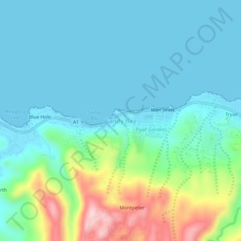
Name: Sandy Bay topographic map, elevation, terrain.
Location: Sandy Bay, Hanover, Cornwall County, Jamaica (18.42961 -78.09672 18.46961 -78.05672)
Average elevation: 60 m
Minimum elevation: -1 m
Maximum elevation: 273 m