
Kap Hoorn topographic map
Interactive map
Click on the map to display elevation.
About this map
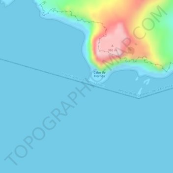
Name: Kap Hoorn topographic map, elevation, terrain.
Average elevation: 39 m
Minimum elevation: -1 m
Maximum elevation: 324 m
Other topographic maps
Click on a map to view its topography, its elevation and its terrain.
Isla London
Chile > XII Region von Magellan und der chilenischen Antarktis > Kap Hoorn
Isla London, Kap Hoorn, Provinz der chilenischen Antarktis, XII Region von Magellan und der chilenischen Antarktis, Chile
Average elevation: 56 m