
一斗泉 topographic map
Interactive map
Click on the map to display elevation.
About this map
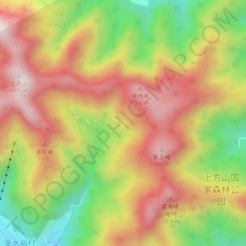
Name: 一斗泉 topographic map, elevation, terrain.
Location: 一斗泉, 上方山登山步道, 圣水峪村, 房山区, 北京市, 中国 (39.67610 115.82562 39.67620 115.82572)
Average elevation: 519 m
Minimum elevation: 169 m
Maximum elevation: 816 m