
Thank you for supporting this site ❤️
Make a donation
Make a donation
Benson topographic map
Click on the map to display elevation.
Thank you for supporting this site ❤️
Make a donation
Make a donation
About this map
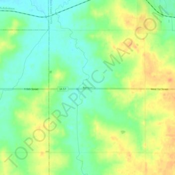
Name: Benson topographic map, elevation, terrain.
Location: Benson, Black Hawk County, Iowa, United States (42.52263 -92.56242 42.56263 -92.52242)
Average elevation: 286 m
Minimum elevation: 268 m
Maximum elevation: 306 m
Thank you for supporting this site ❤️
Make a donation
Make a donation
Other topographic maps
Click on a map to view its topography, its elevation and its terrain.