
Hanshui River topographic map
Interactive map
Click on the map to display elevation.
About this map
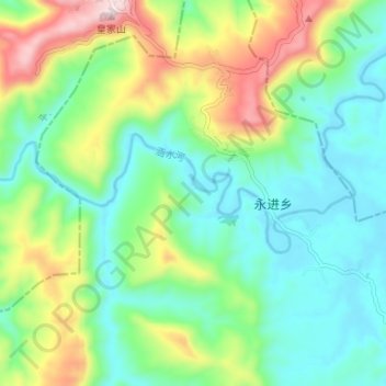
Name: Hanshui River topographic map, elevation, terrain.
Location: Hanshui River, Dachuan District, Dazhou City, Sichuan, PRC (31.33317 107.02937 31.35072 107.09604)
Average elevation: 423 m
Minimum elevation: 288 m
Maximum elevation: 727 m
Other topographic maps
Click on a map to view its topography, its elevation and its terrain.
Yalong River
Yalong River, Litang County, Garzê Tibetan Autonomous Prefecture, Sichuan, 615613, PRC
Average elevation: 3,378 m