
Thank you for supporting this site ❤️
Make a donation
Make a donation
Hall topographic map
Click on the map to display elevation.
Thank you for supporting this site ❤️
Make a donation
Make a donation
About this map
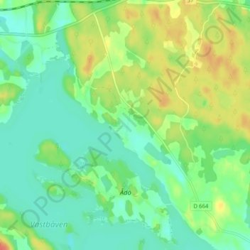
Name: Hall topographic map, elevation, terrain.
Location: Hall, Flens kommun, Södermanland County, 649 91, Sweden (59.02769 16.74716 59.06769 16.78716)
Average elevation: 36 m
Minimum elevation: 19 m
Maximum elevation: 66 m
Thank you for supporting this site ❤️
Make a donation
Make a donation