
Thank you for supporting this site ❤️
Make a donation
Make a donation
Gurua Cell topographic map
Click on the map to display elevation.
Thank you for supporting this site ❤️
Make a donation
Make a donation
About this map
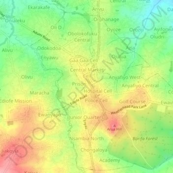
Name: Gurua Cell topographic map, elevation, terrain.
Location: Gurua Cell, Arua Hill, Arua, Northern Region, Uganda (3.00002 30.89054 3.04002 30.93054)
Average elevation: 1,199 m
Minimum elevation: 1,144 m
Maximum elevation: 1,256 m
Thank you for supporting this site ❤️
Make a donation
Make a donation