
Thank you for supporting this site ❤️
Make a donation
Make a donation
Hardtgartenhöfe topographic map
Click on the map to display elevation.
Thank you for supporting this site ❤️
Make a donation
Make a donation
About this map
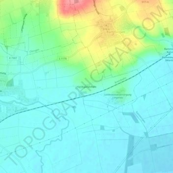
Name: Hardtgartenhöfe topographic map, elevation, terrain.
Average elevation: 473 m
Minimum elevation: 450 m
Maximum elevation: 542 m
Thank you for supporting this site ❤️
Make a donation
Make a donation
Other topographic maps
Click on a map to view its topography, its elevation and its terrain.
Albeck
Deutschland > Baden-Württemberg > Alb-Donau-Kreis > Langenau
Albeck ist ein Stadtteil von Langenau im Alb-Donau-Kreis in Baden-Württemberg, etwa sechs Kilometer westlich des Hauptortes. Er liegt in einer Höhe von 505 m über N.N. Der Ort hat circa 1500 Einwohner.
Average elevation: 528 m