
Make a donation
Lac du Mont-Cenis topographic map
Click on the map to display elevation.
Make a donation
Lac du Mont-Cenis
Mont-Cenis Lake is a lake located in the Mont-Cenis massif at an altitude of 1,974 meters (6,476 ft) in the municipality of Val-Cenis in France. It is situated at the top of the Cenise valley, on the Italian side of the Mont-Cenis pass, the most frequented passage on the Lyon-Turin-Milan axis during the Middle Ages between Western Europe and the Italian peninsula. This was while the Montgenèvre pass required an initial crossing, followed by the Lautaret pass, and the Petit-Saint-Bernard pass was 107 meters (351 ft) higher.
Make a donation
About this map
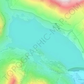
Name: Lac du Mont-Cenis topographic map, elevation, terrain.
Average elevation: 2,096 m
Minimum elevation: 1,849 m
Maximum elevation: 2,809 m
Make a donation
Other topographic maps
Click on a map to view its topography, its elevation and its terrain.