France topographic maps
Click on a map to view its topography, its elevation and its terrain.

Annecy
France > Auvergne-Rhône-Alpes > Annecy
Annecy has an oceanic climate (Köppen Cfb) in spite of its relatively far inland position. Influenced by its elevation, summers are rather moderate on average, although they can be highly variable with extreme heat spikes. Winters see occasional freezing temperatures, but most often stays in the single-digits…
Average elevation: 554 m



Mont Granier
France > Auvergne-Rhône-Alpes > Isère > Chapareillan
454 caves have been identified over an area of 2.8 km2, and form two networks under this small area. To the north, the trou des Auges, ressaut de 108 m, trou des Filous, grotte Arva, and Cuvée des Ours connect with the Granier system, located in the center of the plateau, to form a 55.725 km network over a…
Average elevation: 1,357 m
Brittany
France > Brittany > Landerneau > Loudéac
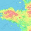
The Armorican massif reaches its maximal elevation outside of Brittany, in neighbouring Mayenne, at 417 m, and slopes towards the west before straightening on its western extremity, with the Montagnes Noires and the Monts d'Arrée. The highest hill in Brittany is the Roc'h Ruz in the Monts d'Arrée, at 385 m…
Average elevation: 50 m






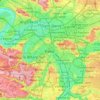
Paris
Paris in its early history had only the rivers Seine and Bièvre for water. From 1809, the Canal de l'Ourcq provided Paris with water from less-polluted rivers to the north-east of the capital. From 1857, the civil engineer Eugène Belgrand, under Napoleon III, oversaw the construction of a series of new…
Average elevation: 75 m



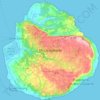
Marie-Galante
The island of Marie-Galante is an elevated atoll resting on a rugged limestone substrate, located on the outer arc of the Caribbean plate. A fault called "la Barre" separates the northern quarter from the rest of the island. The north coast, facing Grande-Terre, is characterized by a high cliff, while the…
Average elevation: 52 m
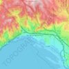
16th Arrondissement
France > Provence-Alpes-Côte d'Azur > Bouches-du-Rhône > Marseille
Average elevation: 98 m

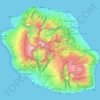


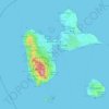
Guadeloupe
The main two islands are Basse-Terre (west) and Grande-Terre (east), which form a butterfly shape as viewed from above, the two 'wings' of which are separated by the Grand Cul-de-Sac Marin, Rivière Salée and Petit Cul-de-Sac Marin. More than half of Guadeloupe's land surface consists of the 847.8 km2…
Average elevation: 37 m
Les Escaldes
France > Occitania > Pyrénées-Orientales > Angoustrine-Villeneuve-des-Escaldes
Average elevation: 1,491 m








Réserve naturelle des Aiguilles rouges
France > Auvergne-Rhône-Alpes > Upper Savoy > Chamonix-Mont-Blanc
Average elevation: 1,951 m

Cilaos
Cilaos (French pronunciation: [silaɔs] ) is a town and commune on the French island of Réunion in the Indian Ocean. It is located centrally on the island, in a caldera of altitude 1,214 m. The caldera (usually known as the 'Cirque') is also named for the community.
Average elevation: 1,536 m


Rapa
Rapa, also called Rapa Iti ("Little Rapa"), is the largest and only inhabited island of the Bass Islands in French Polynesia. An older name for the island is Oparo. The total land area including offshore islets is 40.5 km2 (15.6 sq mi). As of the 2022 census, Rapa had a population of 451. The island's highest…
Average elevation: 1 m
Talau
France > Occitania > Pyrénées-Orientales > Ayguatébia-Talau > Ayguatébia
Average elevation: 1,389 m




Ambernac
France > Nouvelle-Aquitaine > Charente
The relief of the commune is that of a plateau with an average altitude of 190 m; quite hilly as it is traversed from south to north by several valleys including that of the Charente to the west. The highest point of the commune is at an altitude of 232 m located in the Ambouriane Forest in the north-east. The…
Average elevation: 190 m
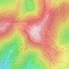
Grand Ballon
France > Grand Est > Haut-Rhin > Goldbach-Altenbach
According to the Köppen climate classification, the top of the Grand Ballon features a subalpine climate (Köppen: Dfc) due to its high altitude comparable to the Alps or the Pyrenees. Along with the Hohneck the summit of the Grand Ballon is the coldest and windiest point in Alsace. A record low of −30.2…
Average elevation: 1,139 m


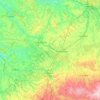
Indre
Indre is divided into four natural regions; North Boischaut is undulating land with an altitude between 80 and 215 m (260 and 710 ft) and occupies the northeast of the department, South Boischaut is hilly and lies in the south and southeast, a marshy tract of land known as Brenne is in the southwestern part of…
Average elevation: 166 m

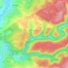


Massif du Luberon
France > Provence-Alpes-Côte d'Azur > Alpes-de-Haute-Provence
The Luberon (French pronunciation: [lyb(ə)ʁɔ̃] or [lybeʁɔ̃]; Provençal: Leberon (classical norm) or Leberoun (Mistralian norm)) is a massif in central Provence in Southern France, part of the French Prealps. It has a maximum elevation of 1,256 metres (4,121 ft) and an area of about 600 square…
Average elevation: 473 m