
Flums topographic map
Interactive map
Click on the map to display elevation.
About this map
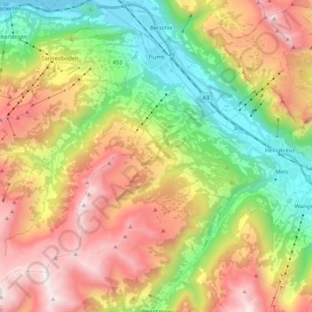
Name: Flums topographic map, elevation, terrain.
Location: Flums, Wahlkreis Sarganserland, Sankt Gallen, Switzerland (47.00043 9.21429 47.10574 9.40262)
Average elevation: 1,328 m
Minimum elevation: 418 m
Maximum elevation: 2,461 m