
Thank you for supporting this site ❤️
Make a donation
Make a donation
Campbell Island topographic map
Click on the map to display elevation.
Thank you for supporting this site ❤️
Make a donation
Make a donation
About this map
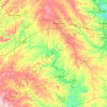
Name: Campbell Island topographic map, elevation, terrain.
Location: Campbell Island, Parker County, Texas, United States (32.25875 -98.15448 32.89875 -97.51448)
Average elevation: 285 m
Minimum elevation: 176 m
Maximum elevation: 441 m
Thank you for supporting this site ❤️
Make a donation
Make a donation
Other topographic maps
Click on a map to view its topography, its elevation and its terrain.