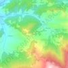
Ovada topographic map
Click on the map to display elevation.
Ovada
The area, located on the northern foothills of the Ligurian-Piedmontese Apennines and at the entrance of the Stura valley leading to the Turchino pass, is hilly, tending to mountainous heading south, with plains where agriculture is practiced and where the industries have established their factories near the main connections. The city lies on the confluence of the Stura of Ovada torrent into the Orba river, at an altitude of 186 meters above sea level.
About this map

Name: Ovada topographic map, elevation, terrain.
Location: Ovada, Alessandria, Piedmont, Italy (44.57863 8.59919 44.66756 8.67227)
Average elevation: 302 m
Minimum elevation: 151 m
Maximum elevation: 835 m
Other topographic maps
Click on a map to view its topography, its elevation and its terrain.