
Thank you for supporting this site ❤️
Make a donation
Make a donation
Malschenberg topographic map
Click on the map to display elevation.
Thank you for supporting this site ❤️
Make a donation
Make a donation
About this map
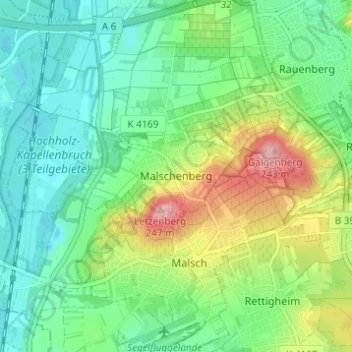
Name: Malschenberg topographic map, elevation, terrain.
Average elevation: 144 m
Minimum elevation: 97 m
Maximum elevation: 245 m
Thank you for supporting this site ❤️
Make a donation
Make a donation
Other topographic maps
Click on a map to view its topography, its elevation and its terrain.
Malschenberg
Deutschland > Baden-Württemberg > Rhein-Neckar-Kreis > Rauenberg
Average elevation: 149 m