
Thank you for supporting this site ❤️
Make a donation
Make a donation
Fintona topographic map
Click on the map to display elevation.
Thank you for supporting this site ❤️
Make a donation
Make a donation
About this map
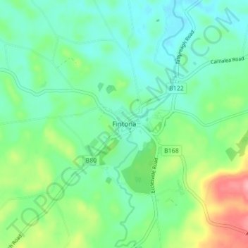
Name: Fintona topographic map, elevation, terrain.
Average elevation: 118 m
Minimum elevation: 87 m
Maximum elevation: 196 m
Thank you for supporting this site ❤️
Make a donation
Make a donation
Other topographic maps
Click on a map to view its topography, its elevation and its terrain.
Castlecaufield
United Kingdom > Northern Ireland > County Tyrone > Castlecaulfield
Average elevation: 95 m
Thank you for supporting this site ❤️
Make a donation
Make a donation
Thank you for supporting this site ❤️
Make a donation
Make a donation
Derry and Strabane District
United Kingdom > Northern Ireland > County Tyrone
Average elevation: 140 m
Thank you for supporting this site ❤️
Make a donation
Make a donation
Thank you for supporting this site ❤️
Make a donation
Make a donation
Thank you for supporting this site ❤️
Make a donation
Make a donation